Just show me the Best Pictures The Best
Pictures and Descriptions. (Scroll Down)
I want to take this trip, what details should I know? Details and Trip Planning
So you wanna go hiking?
The big choice. You’ve been laid off but it was not really unexpected. You could take a couple weeks off and do something before you jump back into the market or just immediately try and find another job. Do you go? Hell yea. Glacier National Park was one of our favorite trips about 6 years ago but we really were only able to see a fraction of the park in 4 days. Since time was really not an issue, and I could travel midweek to save cost I figured now would be a good time to take another look. Louise was not really interested in 7 days of straight hiking, and there were not a lot of other activities, so this one was just me.
The planning was last minute, so finding lodging was difficult and I ended up having to bounce between different rooms most of the trip. They have an earlier check in than most hotels (3:00pm) so it was not much of an issue as I was hiking all day and not back till 4-5 pm. There are four major areas of the park, or which I was most interested in three: Many Glacier, St Mary’s, and Two Medicine. Each had a couple of large hikes that were highly reviewed, and each had available lodging. I ended up extending the trip out to nine days to fly on the cheapest days and padded the trip with a couple of “rain days”.
All said and done it was a good trip and I’m glad that I went. It was fun going on the monster hike, but not something I’m interested in doing again. It seems there are parts of your body and equipment that don’t fail in 10 miles, but will fail in 15-20 miles. Not something you wish to discover at mile 15 of an 18 mile one way hike. Not that I’ll admit Louise, but even I got tired of hiking after 7 days, and if they had a spa, I would have been tempted. If I ever go again, I’ll drag Louise along and do less hiking.
- Going to the Sun Road
- Hiking the High Line
- Apikuni Falls, Saint Mary's Falls, and Virgina Falls
- Syieh Pass
- Avalanche Lake
- Prince of Wales Hotel
- Scenic Point
- Two Medicine Lake
- Odds and Ends
Going to the Sun Road
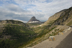
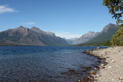
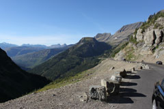
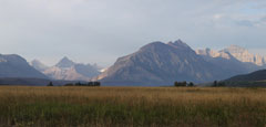
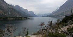
While Glacier is known as a hikers paradise, if you are not into hiking you can still see a huge portion of the park and never leave you car. The Going to the Sun road is an attraction in itself. Just be aware that if you are planning on driving the entire length that it does take far longer than you will expect. There are sections of 15mph and they are always working on one section or another due the damage the road takes every winter.
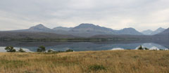
Given the length of this trip I was able to take pictures of the same areas multiple times and on multiple days and I can say that the difference between different days and times is astounding.
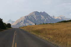
1-9 All are taken along the Going to the Sun Road.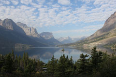 1 |
 2 |
 3 |
 4 |
 5 |
 6 |
 7 |
 8 |
 9 |
Hiking the High Line
Garmin
18.5 Miles, 2300’ Vertical
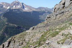
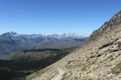
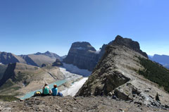
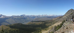
The big hike of the trip. Visions of grander and some really good pictures led me to plan this 18 mile 2,300’ elevation hike. One of the reasons I went on this trip in the first place were some pictures by Phil Armitage of the Grinnell Glacier Overllok. While it was incredible, I was rather beat up by the time it was over.
This is a one way hike from Logan Pass, the Granite Park Chalet, over Swiftcurrent Pass, and back to the Swiftcurrent Motor Lodge in the Many Glacier area. The hiker shuttle left the Swiftcurrent Lodge at 7:30am and got the Saint Mary’s visitors center about 8:15. From there you take the NPS Shuttle to Logan Pass, and arrive about 9:30am to start your hike.
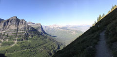
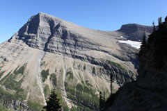
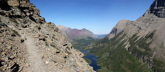
While all of the hike is great, my favorite portion was the section that descended from Swiftcurrent Pass and called the “Devils Elbow”. A sharp turn in the trail makes it look as if the trail is going to go off the cliff and all you can see is this massive wall of rock on the other side of the valley. Breathtaking.
Given a second chance I would bypass the Grinell Glacier overlook. It is a worthwhile view, but better to add it as part of a smaller hike. It’s 1000’ vertical feet in 0.6 miles and just as steep as it sounds. You know how they say “It wasn’t as bad as I thought it would be?”, It wasn’t, it was worse. If 36 min on the stairmaster is not your cup of tea, this might not be for you.
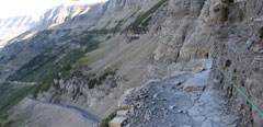
1 : The Beginning of the Highline trail. They have a cable installed for those that are uncomfortable with heights as the Going to the Sun Road is directly below. I don't particular care for heights myself but I didn't find this bad.2 : Section of the Highline before Haystack Butte. If you are only going to Haystack and back, I would do this hike later in the day. Louise and I had done this last time and the lighting is much better.
3 : Section of the Highline after Haystack Butte.
4 : Grinnell Glacier Overlook trail. Pictures don't really convey how steep this is.
5-6 : Grinnell Glacier Overlook
7-8 : The Devils Elbow area of the Swiftcurrent Pass Trail
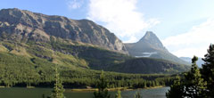
9 : Redrock Lake
 1 |
 2 |
 3 |
 4 |
 5 |
 6 |
 7 |
 8 |
 9 |
Apikuni Falls, Saint Mary's Falls, and Virgina Falls
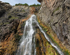
Two different hikes on this day. The first was a short 2.0 mile 650’ Elevation hike up to Appekunny Falls in the Many Glacier Area. While the falls were interesting, the hike up to them was a rather boring uphill walk in the woods without many views. I did like the fact that you could get right up to the falls and when the sun made a quick appearance it was rather nice looking, so if you’re a waterfall person I think you would really like this.
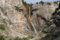
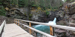
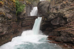
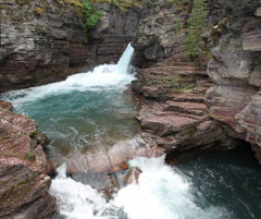
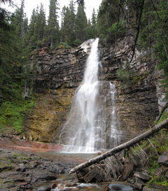
The second hike of the day was the combination St Mary’s and Virginia Falls hike. About 3.4 miles round trip and 400’ of elevation. St. Mary’s is excellent. Great color, great views, and its only about 0.9 miles from the trail head. Virginia falls is only a bit further and while it is bigger it didn’t impress me as much. The weather was bad that day so you may have better results in daylight. All of the horror stories you have heard about the lack of parking at this trailhead are true, it’s a mess. Either take the shuttle or get there before 9:00am. Its popular.
You’ll need either a super wide angle lens or some photo stitching to get the entire falls in one picture. On picture 4 I used the tripod and tried for that fancy long exposure shot. Good, but I think I would have had better luck using a Neutral Density Filter instead of playing with the aperture as some of the edges are still a little soft.
1-2 : Apikuni Falls3-5 : St Mary's Fallls
6 : Virgina Falls
 1 |
 2 |
 3 |
 4 |
 5 |
 6 |
Syieh Pass
Garmin
10.2 Miles, 2200’ Vertical
Another big hike, this time an out and back from the Siyeh Bend on the Going to the Sun Road up to Siyeh pass and back. The original plan was to continue over the pass and end at the Sunrift Gorge. Unfortunately the last day of the hiker shuttle was the day before. Probably for the best as my knee had started bothering me on the downhill of the Swiftcurrent pass hike, and the the downhill from the pass to the Sunrift Gorge is almost 3000’.
It’s a good hike, but maybe not a 10/10 unless you can do this one way. When starting from Siyeh pass the first 2 miles entirely in the trees without views and then next mile is in scrub with limited visibility. After that you do get a clear view, and it is an incredible view. The last 1.5 miles is a rather brutal uphill set of switchbacks. The Garmin trace really doesn’t do this one or the Grinell overlook justice when it comes to steepness. I saw two groups of hikers in the distance that simply turned around at the bottom rather than continue to the top. If you do want to a smaller hike there are a couple of really small lakes in the valley just a little off the trail that would be really fun to take a closer look at.
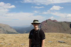
As for myself, I continued up to the top. The actual pass itself is very small, maybe 50’ long and 6-8’ wide. Very cool views. While admiring the scenery I met the only other couple I saw that day and they were nice enough to take my picture. This would be a really cool place to have lunch, but it was slightly hazy that day and I knew it was a long walk back down.
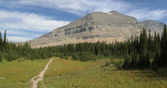
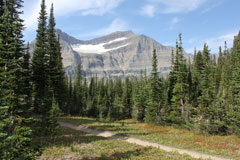
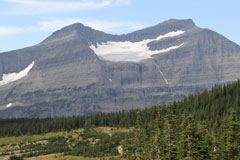
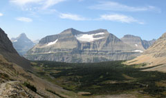
1 : Mt Siyeh in the Distance2 : The Piegan Mountain and Glacier Dominate the view the first half of the hike:
3 : For scale you can just barely see the people on the trail
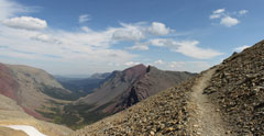
4 : On the switchbacks. I stopped a lot and took a lot of pictures.
5 : Almost there
6 : The pass, no possible way I would try this in rain or snow
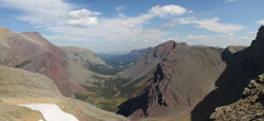
7 : View from the pass area
8 : View down the other side towards the Sunrift Gorge
9 : Me
 1 |
 2 |
 3 |
 4 |
 5 |
 6 |
 7 |
 8 |
 9 |
Avalanche Lake
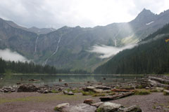
A nice 4.0 mile, 500’ out and back hike to a valley with multiple waterfalls.
The trail is shared with the “Trail of the Cedars” boardwalk so for a change you get views right from the start. Giving the location the Cedars here grow, really, really, big and are older than dirt. After the first half mile the trail splits off to the Avalanche lake trail.
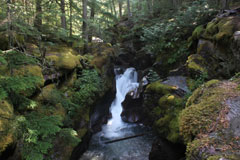
The short growing season also means there is a short season for decay, so there are as many logs lying on the ground as there are standing. Kinda creepy. We called it Mirkwood. The first time Louise and I were here I was not able to get any good pictures due the dim lighting. Digital cameras are better now and I know a couple more tricks so I was able to get some shots, but a tripod was required for most.
On the downside, given the area it rains a lot, and rained on me the most of the trip. While I did get some neat pictures of the forest, I think the pictures of the lake were better the first time I went. I need to remember to take an umbrella for days like that.
1 : Trail of the Cedars2 -3 : Mirkwood, really
4 : I look far drier than I was
5 : I did get a neat sunbeam picture
6 : Trying to be fancy with the camera again
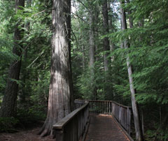 1 |
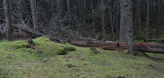 2 |
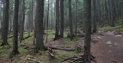 3 |
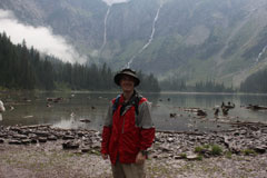 4 |
 5 |
 6 |
Prince of Wales Hotel
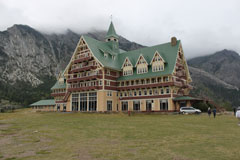
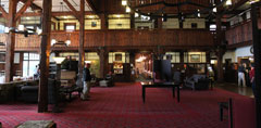
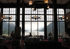
After yesterdays hike in the rain and multiple hikes I was ready for something a little different. The weather report was calling for a 90% chance of rain, so I though a drive might be good. Glacier National Park is actually a joint park with a portion in Canada. The top attraction is the Prince of Wales hotel. Constructed in 1926 it’s an architectural pleasure with 6 all wood construction and 6 stories.
Its about a 1.5-2.0 hr drive from West Glacier on some of the most boring road ever. At 70mph you notice just how little there is to see. Other than the actual border crossing there is not much out there.
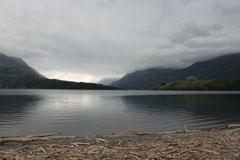
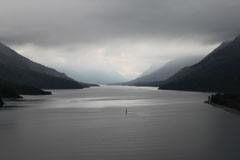
The Hotel is very interesting and the bar has a great view, so it was really not much of a hardship to sit a while and have a drink. Given the weather I got some good ‘moody’ pictures, but I would love to know how it looks in the clear.
 1 |
 2 |
 3 |
 4 |
 5 |
 6 |
Scenic Point
Or not so scenic as the case may be.
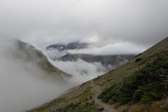
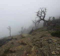
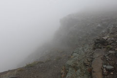
It’s an 7.5 mile, 2300’ elevation hike that is supposed to lead to an incredible view of eastern Montana from a sheer cliff. Unfortunately, given the weather it was an experience in some of the thickest fog I have ever seen in my life.
I knew the weather was not that great when I started but I had hoped that it would either clear or that I would be able to hike up and over the fog, no go. About 3 miles into the hike I passed a couple that were on the way down. They mentioned they were turning around because they got to a point where they could no longer find the trail. I had thought this might be a bit of exaggeration, but I did reach a point where visibility dropped below 30’. Crazy.
A shame the weather was not cooperating because this had all the hallmarks of a great hike. Only the first 1.0 mile was in the trees and then it opened up. About 2.0 miles of climb on the edge of the mountain and then about 1.0 mile along the crest to a view point. If I ever go bad, this is on my ‘do over’ list 1-2 : Going up and visibility going down.3 : The top. I think this is a 500’-1000’ shear cliff, I think.
 1 |
 2 |
 3 |
Two Medicine Lake
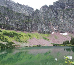
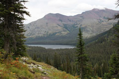
The plan was to take the boat across Two Medicine Lake and then hike to Dawson Pass, but the weather once again was not cooperating. By the time I had reached ‘no name’ lake I could see that the pass was fogged in. There are no good views of No Name and I would not recommend it as a destination.
On the way back to the boat dock I reach the trail intersection for Two Medicine Lake. It was only a 4.5 mile round trip and some people mentioned that it was relatively flat so I figured why not. I got just far enough along the path so that it was to late to catch the next boat and the sky let loose and it started a hard cold rain. Since I was already drenched and the next boat was not for another hour anyway I decided to push on. The rain and wind reached a peak by the time I reached the lake and the wind was howling so bad I could not even stand on the shore and get a good look so I headed back. About a mile down the path, the sun came out. Argghh. Nothing for it but to call this one a wash. The total trip ended up being about 8 miles. From what I did see I think the hike would be interesting and I would be interested in doing it again.
Taking the boat is a definite winner. Just check the boat schedule as the ride I took the week after Labor day was the last of the year
I had some time to kill the day I left, so I went back to the lake to get a couple of pictures. It was a good picture to end the trip with.
1 : No Name Lake2 : The trail to Dawson Pass and No Name Lake
3: The trail to Upper Two Medicine Lake
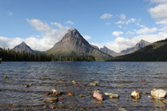
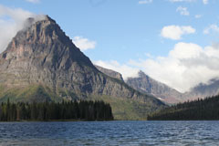
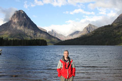
4-6 : Two Medicine Lake
 1 |
 2 |
 3 |
 4 |
 5 |
 6 |
Odds and Ends
And of course there are always a few things that just don’t fit into any other categories. So here is my catch all list of random stuff.
1. Getting that blur look on your waterfall pictures. Its all about shutter speed. If your camera shutter is open longer, the water will blur. The two pictures here were taken at 1/25 (Left, faster) and 1/5 (Right, Slower) of a second. If you have a really basic camera, you probably have no control over this so don’t worry about it. While I love my pocket size Canon Elph, it has no settings you can play with other than “no flash”. Depending on your camera there are a couple of ways to do this. If you have a fully manual camera this is little a hard because you can’t change just one thing. If you open the shutter for longer, you get more light, so if you change nothing else your picture will be over exposed. So, when you open the shutter for longer you have to either reduce the amount of light entering the camera (Aperture) or change the sensitivity of the sensor (iso). Most Mid and High end cameras will have an A or S mode where you set one of these and the camera will automatically adjust the others. And don’t forget the tripod. Anything slower than 1/60 of a second will start to get blurry if you don’t use one. The final settings for these pictures was Left:(1/25 sec F22 Ap 400 iso ), Right:(1/5 sec F25 Ap 100 iso)

2. Some days and times are simply better than others for some locations. I took about 20 pictures of Goose Isle on the fourth day of the trip and only managed this shot for my trouble (Left). The next day while driving to my hike I said "what the heck", jumped out of the car and snapped one quick picture which ended up being one of my favorites of the trip (Right). Sometimes you just have to be in the right location at the right time.

3. This cracked me up. The showers in the Many Glacier Hotel are obviously retrofitted as the hotel was built in the 1920’s when all rooms were on the shared bath plan. They did a great job fitting a full bath into each room, but one of the compromises was installing claw foot tubs in some of the rooms. I think its safe to say that many people get confused when trying to figure out how to use the shower, hence the laminated instructions they posted on the wall. My favorite part is the last line when they say “When you wish to turn off your shower, simply” , SIMPLY? If you need an instruction card with 8 steps there is no ‘simply’ about any of this.
4. One of my favorite pictures from my first trip to Glacier was the sunrise picture of Mt. Grinnell from the Many Glacier Hotel. While I love the picture, it’s a little soft and I really wanted a similar shot with my new camera. I figured this would be easy as I was going to be in the area for 3 mornings and have plenty of chances to get the picture. Unfortunately I didn’t know that the weather conditions for this to happen are not common. While running to catch the hiker shuttle I got this one picture intending to get better pictures the following days, and then found that this was the only day with the weather I needed. Put this on the “next time” list.
5. I just like this picture.

6. Having your picture taken by strangers. If you are traveling alone and want some picture of you sooner or later you going to need to get some strangers to take your picture. My recommendation is to get lots of pictures and don’t count on any one picture. I tried to only ask people that I saw carrying a camera of their own under the assumption that if they were carrying a camera they might know how to use one (a false assumption) and I gave everyone the same simple instructions when I handed them my camera, “Look through THIS viewfinder, press THAT button until it BEEPS and continue pressing till it CLICKS”. WAAAY to much information obviously. 80% of all people could not figure how to hold the camera up to their eye to look through the viewfinder, 50% could not keep pressing the button after it beeped, and 50% couldn’t even take a level picture. At least nobody clipped my head off so I guess that’s a bonus. Lastly, I did manage to avoid the “Captain Morgan” pose this trip (Hands on my hips and one foot propped up on something) but all I managed to do was to find other ways to look goofy in pictures so I’m not sure it was much of an improvement.
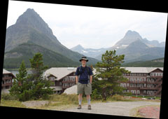
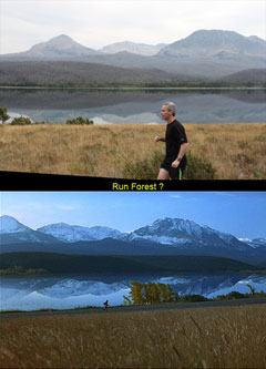
7. In the movie Forest Gump there is a scene where Forest is talking to Jenny about the places he saw while running. In one of them he mentions a “Clear Mountain Lake” with a reflection so clear he couldn’t tell where the mountains stopped and heaven began. That shot was taken in Glacier National Park along the Going to the Sun Road at St. Mary’s Lake. While driving out to a morning hike I passed the same area and wind was low and the reflection was perfect. Getting a picture of yourself by yourself while jogging past the camera was a little harder. I had to get a lot closer to the camera so the remote would trigger and I ended up jogging in the opposite direction, but it was still fun.
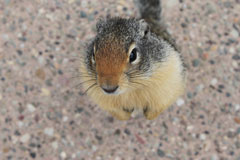
8. Everyone loves squirrels right?
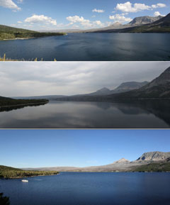
9. St Mary’s Lake on different days at different times. After review all of the pictures from the trip I noticed I had 3 pictures of this lake from the same spot. I must have liked it. Its very interesting how different each picture is given they are all from the same camera and taken within days of each other. I noticed an interesting effect with many of the lakes regarding color. Namely that the color of the lake could change radically depending on the angle you were viewing it from. There were multiple times where I saw an incredible blue in a lake from the road, only to find the color gone when I reached a turn off if the turn off was at a lower elevation.
